Major anchor place
Chattanooga at a glance
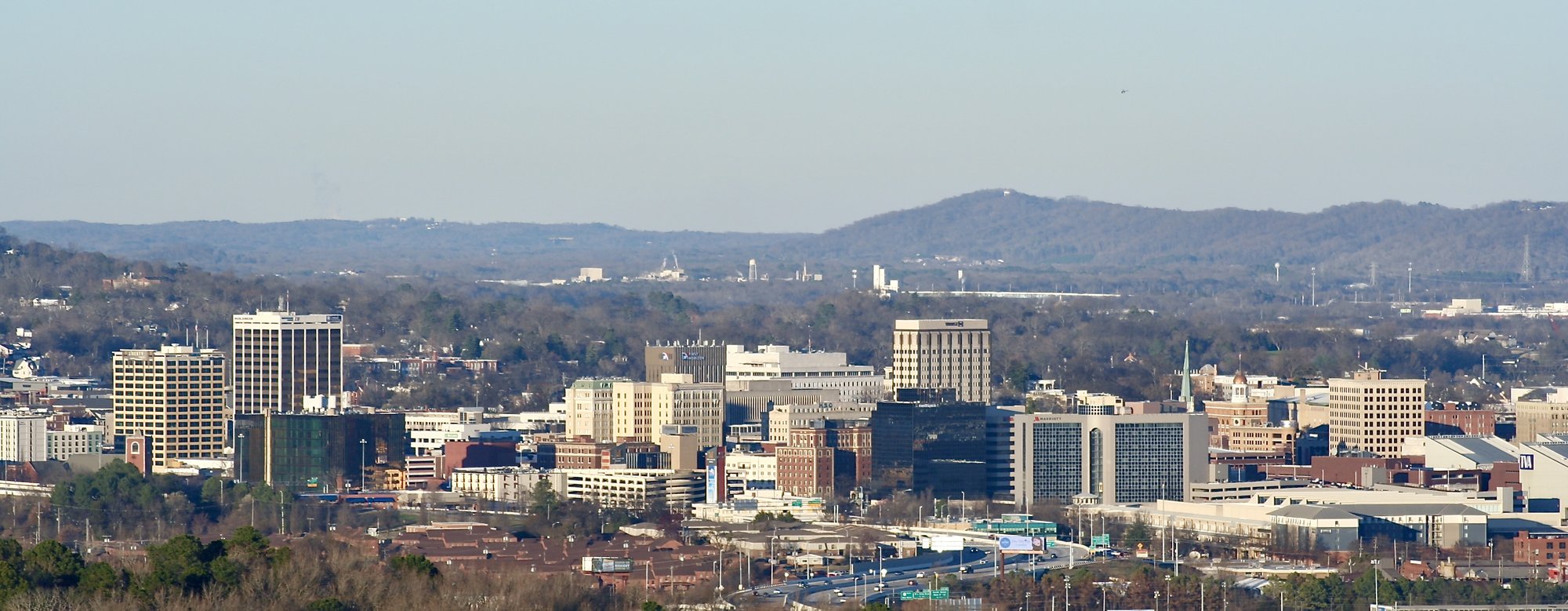
Chattanooga is the major Tennessee River and mountain-transition anchor on Route 41. TDOT mapping and corridor material show a complex urban passage: US 41 shares the southeast approach with US 76, crosses a dense city road network, and continues west on the Broad Street/Cummings Highway corridor as SR 2. Travelers should choose deliberately among a through-city drive, an overnight, a riverfront or Southside stop, and a separately planned Lookout Mountain visit.
Northbound, decide before Chattanooga whether the city is a through-drive, overnight, focused riverfront/Southside stop, or full city day.
How to use Chattanooga on Route 41
1 · Planning cue
Choose the stop role first
Northbound, decide before Chattanooga whether the city is a through-drive, overnight, focused riverfront/Southside stop, or full city day.
2 · Planning cue
Use direction to shape the stop
Southbound, use Chattanooga as the last major Tennessee resupply and overnight anchor before Dalton and the Georgia corridor.
3 · Planning cue
Keep the route and destination layers distinct
Keep the signed urban crossing, I-24/I-75, downtown, riverfront, Southside, and Lookout Mountain as distinct planning layers.
Why Chattanooga matters on Route41
Chattanooga closes the Atlanta and North Georgia chapter and opens the Tennessee plateau chapter. The Tennessee River, the city street network, and the mountain-and-plateau transition make this a decision point rather than a compact corridor stop. Give the city the amount of time the trip can genuinely support, then keep its selected layers separate.
US 41 shares the southeast approach into Chattanooga with US 76. Its urban passage is complex, and the westward continuation follows the Broad Street/Cummings Highway corridor as US 41/SR 2. I-24 and I-75 can materially affect traffic and pacing, but they are not substitutes for Route41; use current signage and navigation for exact turns rather than treating this page as directions.
Northbound and southbound use
Northbound, decide before reaching Chattanooga whether it is a through-drive, overnight, focused stop, or full day. After Dalton, it is the major meal, lodging, and route-orientation decision; separate any riverfront or mountain time from the driving plan. When leaving, treat the Monteagle climb and plateau transition as a separate planning problem rather than an extension of a city day.
Southbound, Chattanooga is the final major Tennessee lodging, food, resupply, and city anchor before the Dalton and North Georgia sequence. Decide whether the city receives its time before leaving the metro network, then prepare for a calmer Georgia stretch without trying to combine it with a dense city or mountain schedule.
Route, city, riverfront, and mountain choices
The signed Route41 urban passage, I-24 and I-75, downtown, the Tennessee Riverfront, the Tennessee Riverwalk, Southside, and Lookout Mountain each serve a different job. Downtown, the Riverfront, Riverwalk, and Southside can support a selected city layer; none should be assumed to be one compact roadside cluster.
Lookout Mountain, Point Park, and other National Park Service destinations need their own access, time, and current-condition plan. They can make Chattanooga a larger day, but they should not be folded into a quick drive through the city. The westward plateau continuation deserves its own time and route attention as well.
Planning weight
Chattanooga can support a carefully prepared through-drive, an arrival evening and overnight, a focused riverfront or Southside stop, a full city day, or a separately planned Lookout Mountain or National Park Service visit. The useful choice is not to collect every layer, but to select the one that fits the day’s driving and the next terrain transition.
Practical route utility
Traffic, construction, incidents, events, parking, lodging availability, riverfront access, mountain access, trail conditions, shuttle operations, attraction hours, fees, closures, and weather can change. Check current road, park, lodging, and destination information before relying on a city or mountain plan.
Route layers to use from Chattanooga
Use these pages to move from the stop-level decision back to the state chapter, the connected trip shape, and the wider Route 41 corridor.
State context
Tennessee
Use the state gateway when you need the larger corridor sequence, branch distinctions, and the next cross-state handoff.
Connected trip
Atlanta to Nashville
Use the Tennessee approach trip frame through Chattanooga and Monteagle.
Whole corridor
Route 41 overview
Zoom out when this stop needs to be compared with the full Miami-to-Copper Harbor road sequence.
Nearby route handoff
Monteagle
Open the nearby place guide when the next decision is where to pause, reset, or continue on the corridor.
Related existing pages
- Kennesaw
- Monteagle
- Atlanta and Tennessee handoff
- Tennessee plateau and city sequence
- All Route41 places